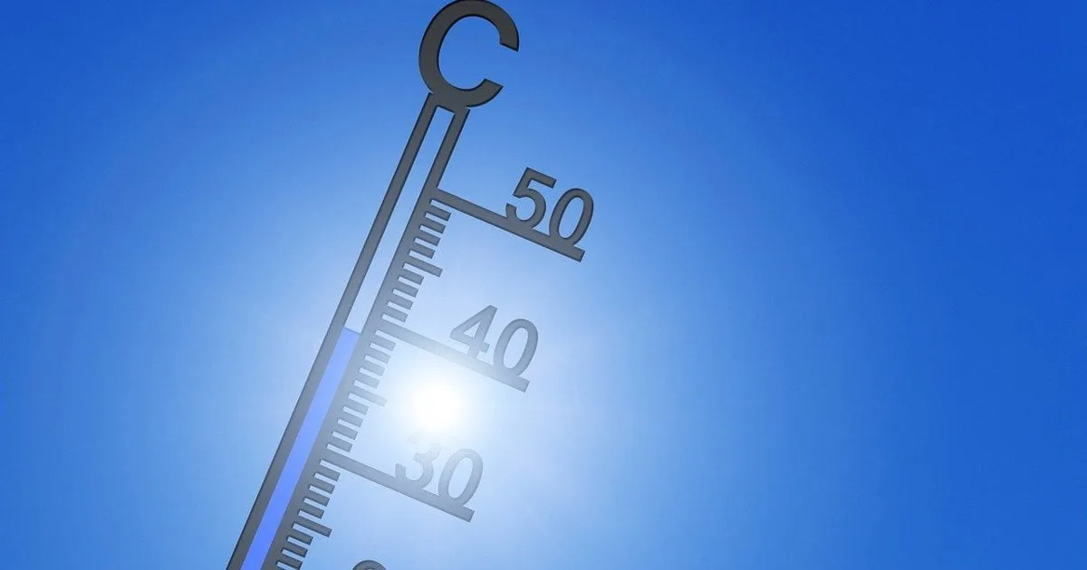
The EU's climate monitor, the Copernicus Climate Change Service, said on Monday that El Nino has broken a temperature record in a key part of the Pacific. This happened in September. It is another sign that this weather pattern is getting unusually strong.
Forecasters around the world have warned for months that this El Nino would probably become the strongest ever seen. The new record came before the event is even expected to peak later this year.
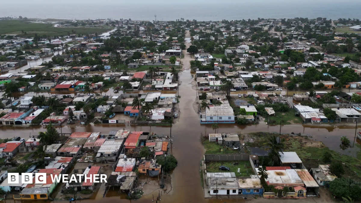
El Nino is the warm phase of a natural climate cycle. It heats up the sea in the tropical Pacific and changes the weather. That can raise the risk of drought and floods, and it can make man-made global warming worse.
Copernicus said that sea surface temperatures in an area called Nino3.4, which is watched to track El Nino, reached an all-time high of 29.70C last month. That was higher than the peaks of earlier strong events in 1982/1983, 1997/1998 and 2015/2016. The monitor said this underlines how intense the current El Nino is.
But Copernicus also told the AFP news agency that it cannot yet say that this is the strongest El Nino ever recorded. The reason is that climate change warms the oceans. This can make recent El Nino events look stronger than old ones, so comparing across the years is tricky.
Copernicus has begun using a new index that takes the warming of tropical oceans into account. By that measure, the current event is not yet stronger than past ones. Still, the September values point to an already exceptionally strong El Nino, especially since it has not reached its peak yet.
Not every forecaster reads El Nino in the same way. On Friday, Japan's weather agency said El Nino conditions had reached their strongest intensity on record. It said temperatures in the monitoring area were 4C above normal.
As El Nino grows, the average sea surface temperature of the whole world hit a record 21.05C for September. The old September record was 20.92C, set in 2023. The world also had its second hottest September on record, with air temperatures at the surface averaging 16.27C. That was 1.63C hotter than the pre-industrial average, which is measured over the years 1850 to 1900.
At the 2015 UN climate talks in Paris, countries agreed to keep warming well below 2C above pre-industrial levels. They also agreed to try to hold it to 1.5C. In September, the United Nations said the long-term 1.5C goal would be missed within a few years.
Copernicus director Carlo Buontempo said in a statement: "We are in a new run of months above 1.5C, and with a strong El Nino still intensifying it is likely to last into 2027." He added: "Crossing the Paris Agreement's long-term limit is only a matter of time. How far we overshoot, and for how long, is still up to us."
Scientists say it is vital to cut greenhouse gas emissions from fossil fuels. That would shorten the time spent above 1.5C and bring temperatures down as fast as possible. Experts have also warned that this El Nino will probably push global temperatures to a new record in 2027.
El Nino warms the surface of the central and eastern equatorial Pacific Ocean. It brings changes in winds, air pressure and rainfall around the world. It usually happens every two to seven years and lasts about nine to 12 months.
Text and photos: ewn.co.za · 12.10 — original →
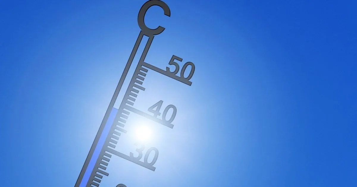
The EU's climate monitor, called Copernicus, said on Monday that El Nino broke a temperature record in September. The record was set in a key part of the Pacific Ocean. The monitor sees it as another sign that this weather pattern is getting unusually strong.
Forecasters around the world have warned for months that this El Nino could become the strongest ever seen. The new record came even before the event is expected to reach its peak later this year.
El Nino is the warm phase of a natural climate cycle. It heats up the sea in the tropical Pacific. That changes the weather and can raise the risk of drought and floods. It can also make human-caused global warming worse.
Copernicus looked at a region of the Pacific called Nino3.4, which is used to track El Nino. Sea surface temperatures there reached an all-time high of 29.70C last month. That is higher than the peaks of the strong El Nino events of 1982/1983, 1997/1998 and 2015/2016. The monitor said this shows how exceptional the current El Nino is.
Still, Copernicus told AFP it cannot yet say this is the strongest El Nino ever recorded. The reason is that climate change keeps warming the oceans. That can make recent El Nino events look stronger than old ones, so comparing across the years is hard. Copernicus has switched to a new index that takes the warming of tropical oceans into account. By that index, the current event is not yet stronger than the past ones. But Copernicus said the September numbers point to an El Nino that is already exceptionally strong, especially since it has not peaked yet.
Not every forecaster uses the same scale. On Friday, Japan's weather agency said El Nino conditions had reached their strongest intensity on record. It said temperatures in the monitoring area were 4C above normal.
The wider ocean is also record warm. Copernicus said the global average sea surface temperature for September was 21.05C. The old record for September was 20.92C, set in 2023.
On land and in the air, the world had its second hottest September on record. Surface air temperatures averaged 16.27C. That was 1.63C hotter than the pre-industrial average, which is measured over the years 1850 to 1900.
At the 2015 UN climate talks in Paris, countries agreed to keep warming well below 2C above pre-industrial levels. They also agreed to try to hold it to 1.5C. In September, the United Nations said the long-term 1.5C goal would be missed within a few years.
Copernicus director Carlo Buontempo said the world is in a new run of months above 1.5C. With a strong El Nino still building, he said, this will likely last into 2027. He added that passing the Paris limit is only a matter of time, and that how far we overshoot and for how long is still up to us.
Scientists say cutting greenhouse gas emissions from fossil fuels is crucial. It would shorten the time spent above 1.5C and bring temperatures down faster. Experts have also warned that this El Nino will likely push global temperatures to a new record in 2027.
El Nino warms the surface of the central and eastern Pacific near the equator. It changes winds, air pressure and rainfall around the world. It usually comes every two to seven years and lasts about nine to 12 months.
Text and photos: ewn.co.za · 12.10 — original →
A climate pattern called El Niño is growing in the Pacific Ocean. Forecasters expect it to get much stronger during the second half of 2026. Some of them warn it could turn into a rare "super" El Niño and land among the strongest on record. NOAA, the U.S. weather and ocean agency, says El Niño conditions are already in place in the tropical Pacific. It expects them to build through the end of the year. Some forecast models show the event matching or even beating famous past episodes.
El Niño is a natural pattern in which the sea surface in the central and eastern tropical Pacific gets warmer than normal. That warm water changes how air moves around the planet. It shifts rainfall, storm paths and temperatures far from the Pacific. "Super" is not an official word. Some meteorologists use it for an exceptionally strong event, usually when the ocean runs more than about 2 degrees Celsius above average. These events are rare. Since 1950 only a handful have happened, including 1982-83, 1997-98 and 2015-16. NOAA does not use the word "super" and calls the current event "very strong."
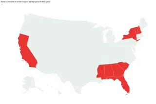
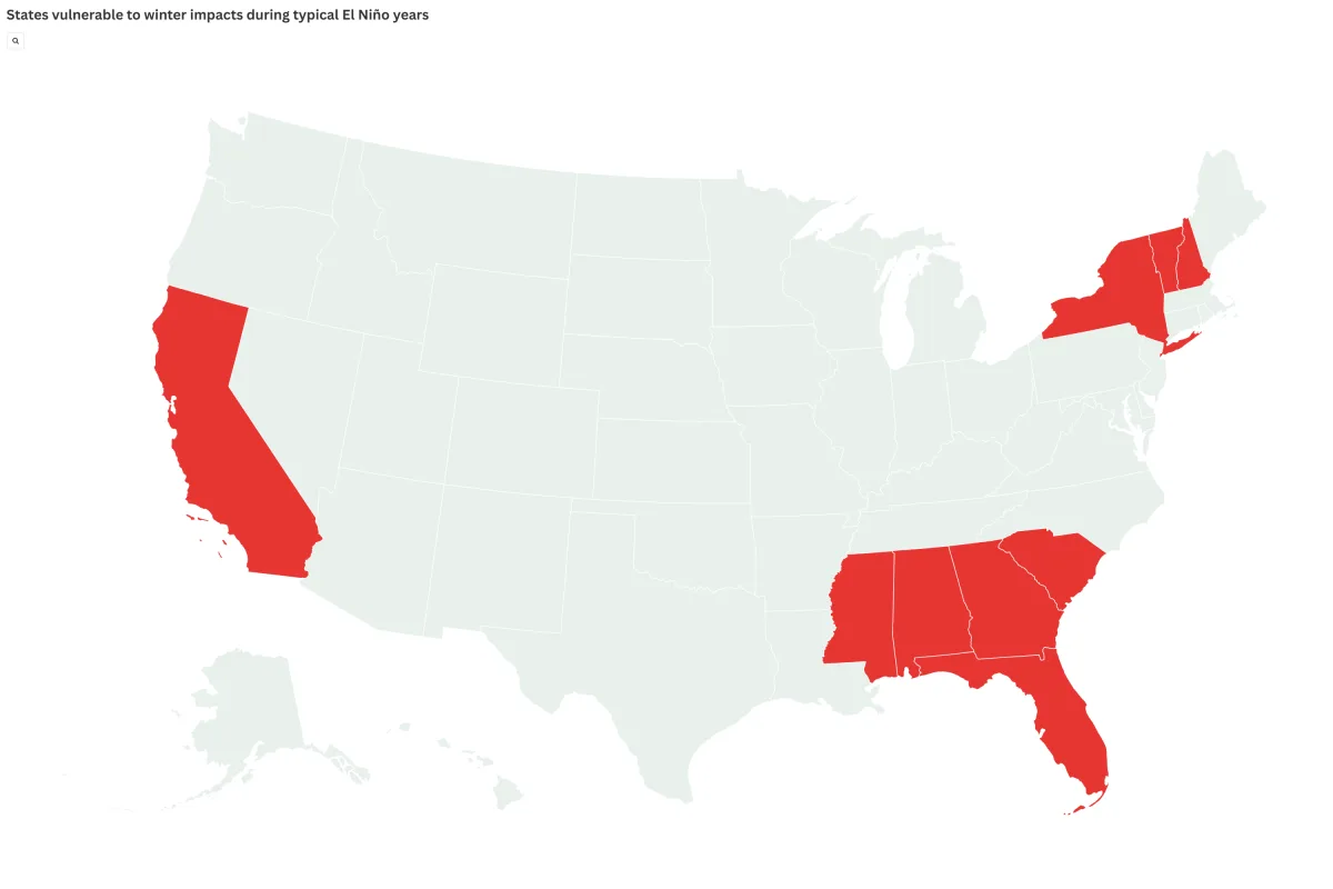
El Niño moves the jet stream and changes where storms form and travel. In the United States, strong events often bring wetter weather to parts of the South and to California. They also make warmer-than-normal weather more likely in some northern states. Johnna Infanti, a meteorologist at NOAA's Climate Prediction Center, told Newsweek that forecasters expect above-normal precipitation in fall and winter over much of the Southern U.S. She said the highest chances are over the Gulf States and parts of the Southeast to Mid-Atlantic, where confidence is greatest.
The Climate Prediction Center says El Niño should keep strengthening through the rest of 2026. It gives an 81 percent chance of a very strong El Niño from October through December. The peak is likely in late fall or early winter. The center also warned that even the strongest events do not give the same effects everywhere. It said stronger events can tilt the odds more toward the expected results. NOAA puts the chance that El Niño lasts into early spring 2027 at 97 percent.
Other groups see a possible giant event too. NOAA's Geophysical Fluid Dynamics Laboratory said all 30 members of its experimental SPEAR forecast ensemble show a very strong El Niño peaking later this year. Every one of them reaches a strength at least competitive with the strongest events seen in the past century.
Exact U.S. effects are not yet known. Paul Pastelok, AccuWeather's lead long-range forecaster, told Newsweek that other climate factors can change the outcome. AccuWeather plans to publish its official winter forecast in early October. In general, some states are more exposed. In Southern California, winter can bring very heavy rain, and the central Sierra Nevada can "get a lot more snow," Pastelok said. Florida is more likely to see severe winter storms, including tornadoes.
Mark Wiley, a duty officer with the National Weather Service, said the risk of flash floods and river floods would rise, along with severe weather and tornadoes. He named the Deep South, the Gulf Coast and Florida as the highest-risk area. He added that a strong El Niño raises the chance of winter precipitation across the South if enough cold air is present, especially freezing rain.
History points the same way. California is watched closely because a stronger Pacific jet stream can steer powerful storms into it, bringing heavy rain, flooding and mountain snow. Across the Gulf Coast and Southeast, including Texas, Louisiana, Mississippi, Alabama, Georgia and Florida, strong El Niño winters have often been wetter than average, with more severe weather in the cool season. Parts of the northern U.S. and the Pacific Northwest often turn warmer and drier, though results can differ a lot from year to year.
Scientists are watching a large pool of unusually warm water deep under the Pacific's surface. NOAA says this hidden heat is helping feed the growth of El Niño. Changing winds over the tropical Pacific also suggest the ocean and air are linking more tightly, which usually helps the event grow. Because the strongest events can affect winter storms, floods, farming and hurricanes, small changes in ocean temperature in the coming months could matter a lot for seasonal outlooks.
The sea itself may change too. According to USA Today, marine scientists expect the warm water to pull more kinds of sea life into West Coast waters. These include young white sharks, stingrays, mahi mahi, bluefin tuna, sea turtles and even yellow-bellied sea snakes. Douglas McCauley, director of the Benioff Ocean Initiative at the University of California, Santa Barbara, expects "all kinds of weird tropical things" to move north. The change could be most visible off California, where El Niño can disrupt the cold, nutrient-rich upwelling that feeds the coastal food chain.
Chris Lowe, a marine biology professor and director of the Shark Lab at Long Beach State University, said the shift can create "this whole different ocean." Squid, anchovies and sardines can be pushed north. Past El Niño events have coincided with hammerhead, tiger and bull sharks showing up off California.
Experts say confidence is growing that El Niño will become very strong. They also stress that no two events are the same, and local weather may not follow past patterns. If the Pacific keeps warming at the current pace, the 2026-27 El Niño could rank among the strongest on record. Emergency managers, water agencies and weather offices in vulnerable states are already watching closely. The article was updated on July 31, 2026, with more information.
Text and photos: newsweek.com · 17.10 — original →